


Introduction:
Tsing Yi (Chinese: 青衣), sometimes referred to as Tsing Yi Island (Chinese: 青衣島), is an island in the urban area of Hong Kong, to the northwest of Hong Kong Island and south of Tsuen Wan. With an area of 10.69 km², the island has extended drastically by reclamation along almost all its natural shore and the annexation of Nga Ying Chau (牙鷹洲) and Chau Tsai. Three major bays or harbours, Tsing Yi Lagoon, Mun Tsai Tong and Tsing Yi Bay (青衣灣) in the northeast, have been completely reclaimed for new towns. The island generally is zoned into four quarters: the northeast quarter is a residential area, the southeast quarter is Tsing Yi Town, the southwest holds heavy industry, and the northwest includes a recreation trail, a transportation interchange and some dockyards and ship building industry. The island is in the northwest of Victoria Harbour and part of its coastline is subject to the Protection of the Harbour Ordinance. Tsing Yi (青衣) iterally means "green (or blue) clothes", but is also a kind of fish, probably blackspot tuskfish, once abundant in nearby waters. People named the island after the fish. Tsing Yi Tam (青衣潭, lit. Tsing Yi Pool) or Tsing Yi Tam Shan (青衣潭山, lit. Tsing Yi Pool Hill) also appeared on some early Chinese maps. The island was also known as Chun Fa Lok (春花落) once upon a time, which means the fall of spring flowers, or Chun Fa Island, on some Western maps. Now, Chun Fa Lok is still a place name or a former village on the southeast corner of the island. A government document in the Ming Dynasty named the water near Chun Fa Lok Chun Fa Yeung (春花洋). The Ming navy defeated once pirate fleets there. In some historical sources, Tsing-I Island is used instead of Tsing Yi Island, and Chung-Hue Island instead of Chun Fa Island. Tsing Yi Town, together with Kwai Chung Town, is part of Tsuen Wan New Town in the Kwai Tsing District in the New Territories. Although Tsing Yi Island is a de facto outlying island, it is not accordingly included in the Islands District. Historically, Tsing Yi Island, with Kwai Chung, were usually in the same administration unit as Tsuen Wan because of their proximity and close-knit neighbourhood. Unlike Kwai Chung, however, whose villages are part of Tsuen Wan Rural Committee, Tsing Yi Island has its own, Tsing Yi Rural Committee. The rural committee was politically significant until the establishment of a District Council and Regional Council (now-abolished), and even less significant since the urban population grew much larger than the rural population. There were about 4,000 people on the island when the British took the New Territories around 1898. In the following one hundred years, the population has grown to nearly 50 times this size; the 2001 Census calculating that the population of the island was 193,432 in 55,478 households. In an estimation in 2007, there are about 200,400 people.[1] It is expected to grow to 203,300 in the near future. Most of the population live in Tsing Yi Town.
No.5 subway
Top Things to Do in Tsing Yi

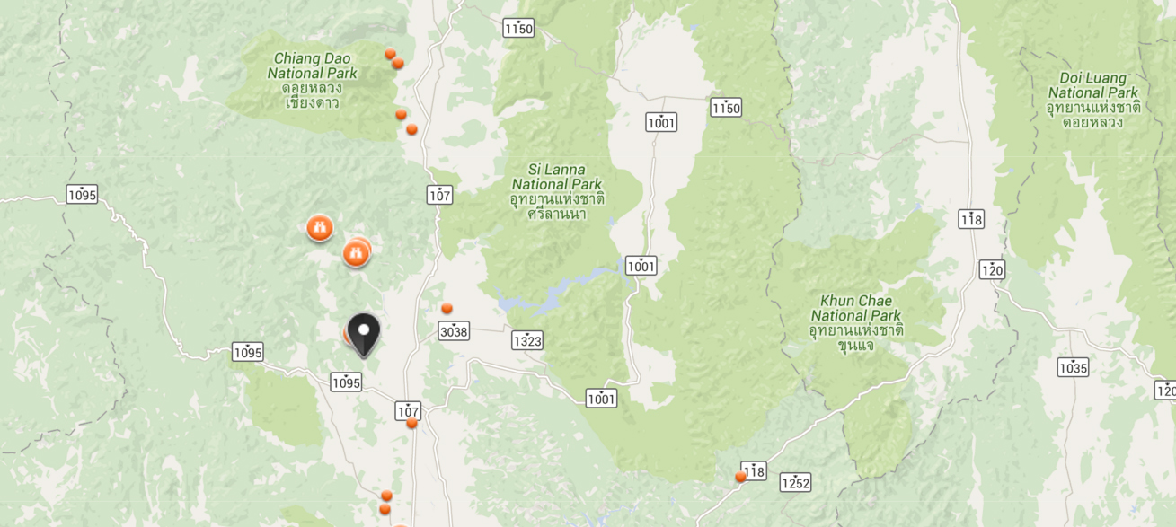
Where is Tsing Yi


Reviews (10)