


Introduction:
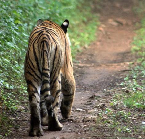
Ma On Shan Country Park (Chinese: 馬鞍山郊野公園) is a park located in the central neck of the Sai Kung peninsula in the eastern New Territories. It was established on April 27, 1979, and contains some of Hong Kong's most dramatic scenery. The park covers an area of 28.8 square kilometres (11.1 sq mi) and links the Sai Kung Country Park and Lion Rock Country Park to form an extensive recreation area on the Ma On Shan massif. Apart from a separate section of the park on the Hebe Haven peninsula, much of the Ma On Shan Country Park is inland. Distant vistas of the sea and off-shore islands open up from many of the high vantage points within the park's boundaries, but most of the exploring keeps you far from the coast. Iron mining has long been carried out at Ma On Shan. The lease of the mine expired in 1981 and activity has meanwhile diminished as the quality of the ore has declined. Concealed mine shafts and man-made scree slopes are potentially dangerous and the area around the mine–excluded from the park, although surrounded by it–should be explored with care. Most of these hills are somewhat bare in terms of vegetation. Their inaccessibility made it uneconomic to carry out afforestation when tree planting was necessary for fuel supply; the mainly volcanic slopes are inhospitable to all but the hardiest plants. Nevertheless, some unusual pockets of vegetation have survived over the years and even the ruined slopes of Ma On Shan are notable for their wild rhododendron, orchids and some unusual ferns. The secluded and unspoilt surroundings have fostered a range of wildlife within the park. Pangolin, barking deer, porcupine and wild boar are still seen from time to time. Coordinates: 22°24′43″N 114°14′52″E / 22.4120°N 114.2479°E / 22.4120; 114.2479
No.3 subway
Top Things to Do in Ma On Shan Country Park

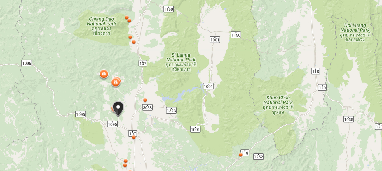
Where is Ma On Shan Country Park


Reviews (10)