


Introduction:
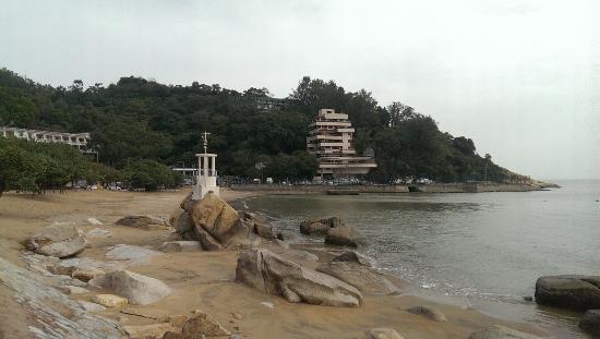
Punaluʻu Beach (also called Black Sand Beach) is a beach between Pāhala and Nāʻālehu on the Big Island of the U.S. state of Hawaii. The beach has black sand made of basalt and created by lava flowing into the ocean which explodes as it reaches the ocean and cools. This volcanic activity is in the Hawaiʻi Volcanoes National Park. Punaluʻu is frequented by endangered hawksbill and green turtles, which can often be seen basking on the black sand. The swimming area is very rocky, and it can be dangerous to swim. The beach also has a large amount of underground fresh water that flows in it. This fresh water is very cold and looks almost like gasoline mixing with the water. Legend has it that in the time of drought, the ancient Hawaiians living in the area would dive underwater with a jug to get their fresh water. In the Hawaiian language puna luʻu means "spring [water] diver for".[1] The beach is located at coordinates 19°08′10″N 155°30′14″W / 19.136°N 155.504°W / 19.136; -155.504Coordinates: 19°08′10″N 155°30′14″W / 19.136°N 155.504°W / 19.136; -155.504. Access is from the Hawaii Belt Road: take Ninole loop road or the entrance to the Sea Mountain Resort. Camping is permitted at the Punaluʻu Black Sand Beach Park.[2] Punaluʻu and adjacent areas provide evidence of the shifts in use of sacred space over time. Monumental architecture in the form of large heiau complexes (ritual centers) speak to the power of the aliʻi (ruling class) and the social stratification of the ancient Kaʻū district. With the advent of missionaries arriving in the district as early as 1833, Christianity left its distinct architectural hallmark on the landscape of Kaʻū. Sitting on the ridge above Punaluʻu is the Hōkūloa Church, a Memorial Chapel and graveyard built near the birthplace of Henry ʻŌpūkahaʻia (1792–1818) who inspired the missionary movement that forever changed Hawaii.[3] There are three pre-contact heiau within the immediate vicinity of Punaluʻu. The walled heiau was introduced to Hawaii about 1100 and Punaluʻuu is one of the last places in Hawaii where one can enjoy an unaltered view from one heiau to the next. To the south lies Kaʻieʻi.e. Heiau. Thought to be a fishing shrine the heiau was built on a prominent bluff overlooking the ocean to the south, what were once the Ninole fishponds to the west and Koloa Bay to the east—home of the legendary na ʻiliʻili hanau (birthing stones) said to have supernatural ability to propagate. These smooth, water-polished stones were highly desired and were used for paving heiau, for arming slingshots and as game pieces for the Hawaiian game konane. The name Kaʻieʻi.e. is thought to refer to a type of fishing trap or weir made of the fibrous ʻieʻie vine. Considered to be in good condition by early surveyors, several walls and a raised stone platform are all that remain of Kaʻieʻi.e. today. Recent scholarship has interpreted the site as multi-functional. It likely served as a place of offerings and tributes, an observation point for monitoring the fishponds as well as a communications relay and dissemination location. The heiau complex of Lanipau was heavily impacted by the construction of the Sea Mountain Resort golf course. Once the largest of the three, today what remains of Lanipau is in essence an “island” swallowed up by a sea of putting and driving greens. The heiau complex that sits overlooking the ocean and Punaluʻu Beach is referred to by many names including Halelau, Kaneʻeleʻele; Mailekini or Punaluʻu Nui. This hieau likely extended to the edge of the cliff at Punaluʻu Bay. Its westernmost boundary was destroyed to make way for the construction of a wharf–warehouse complex for the sugar company in 1906. Identified as a heiau luakini (human sacrifice temple), a large table-like stone rests outside the southernmost wall and is known locally as Pohaku Mohai (sacrificial stone). Early site surveys noted possible kauhale (houses) adjacent to the heiau that were likely the residences of na kahuna (religious specialists). Another important cultural feature is Ala Kahakai (trail by the sea) that served as an important link between ritual centers and coastal communities. The ala kahakai was thought to be the original route taken by the God Lono from North Kohala to the southernmost tip of the island and then windward along the Kaʻu coast to Puna. This trail once paved with the na ʻiliʻili hanau was designated as a National Historic Trail in 2000 and remnants can be found at both Punaluʻu Nui and Kaʻieʻi.e. heiau.
No.8 subway
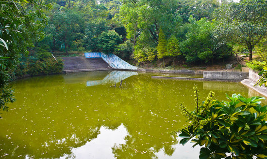
Top Things to Do in Black Sand Beach

Where is Black Sand Beach


Reviews (10)