|
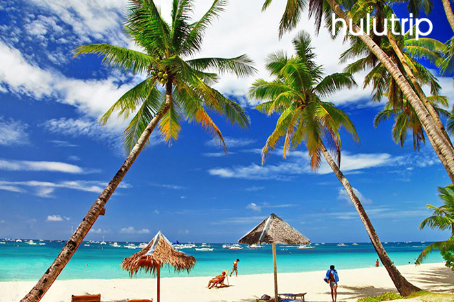
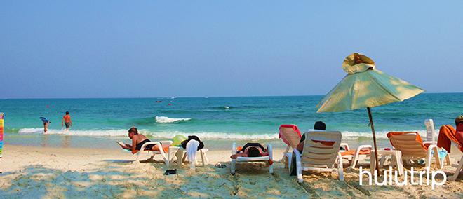
Koh Samet Snorkeling Day Tour : Transportation , Price , Q & A , Nearby , E-ticket Koh Samet Island is located 220 km from the capital in the Gulf of Thailand.It is also alternately transliterated as Koh Samed or Ko Samed or Ko Samet.Ko Samet is approximately 13.1 square kilometres (5.1 sq mi) in size, and shaped somewhat like the letter "t". Along the length of the "t" (north-south) the island measures approximately 7 km, and measures 4 km across the "t" (west-east). Forests blanket up to 80 percent of the total area. Closest to the mainland, lies the small island port village of Na Dan, commonly known as Ko Samet Village, with its nearby beach,Hat Sai Kaeo (Thai: หาดทรายแก้ว), the longest beach on Ko Samet. And Hat Sai Kaeo is usually called Diamond Beach.Most of Ko Samet's beaches lie along the eastern shore of the island. Ko Samet is one of the driest archipelagos in Thailand. Ko Samet gets significantly less rainfall than Rayong Province, even though it is only a few kilometres offshore. The island's "rainy season" extends only from May to July, but even during this season it has less rain than other islands in Thailand. The island, despite being arid, consists of lush forested hills, covered with evergreen and deciduous forest and cajeput trees grow abundantly. Owing to the lack of rain, Ko Samet must import potable water from the mainland. There are 14 white sand beaches on the island, which are surrounded by colourful coral reefs providing such aquatic sports as swimming,snorkeling and scuba diving. The most popular beach areas are: Saikaew Beach, Ao Phai and Ao Vong Duan.The Best time to visit is from October - May. Koh Samed is one of the driest archipelagos in Thailand. Koh Samed gets significantly less rainfall than Rayong province, even though its only a few kilometres offshore. Pattaya Cabaret Show: Alcazar Show Tiffany Show Aphrodite Cabaret Show Simon Cabaret Show Pattaya Adult Show: Russian Show Live Sex Show 69 Show Dragon Club Sex Boyz Dance |
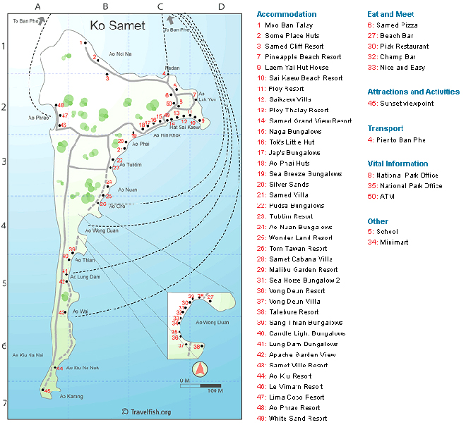
Koh Samet Island Location & Map
November 24, 2015
VIEWED: 0
Recommended Products
see all-
Tunisia Family Holiday
HKD 1535 + Book -
Zanzibar to Vic Falls
HKD 1925 + Book
More Readings
More In Macau
-

SÓNAR HONG KONG
SÓNAR HONG KONG is highlighted by DJ Shadow, Gi...
Sky 100 HK High Cheers for 4 Package
Sky 100 HK High Cheers for 4 Package Official pr... -

Hong Kong SAR Establishment Day Fireworks Dinner...
International dinner buffet, live band, sightsee...
Ngau Cang Japanese Seafood Dinner
Here can you have the freshest seafood which are...
Harbour Cruise Bauhinia A Symphony of Lights Din...

